---
license: mit
task_categories:
- image-text-to-text
- video-text-to-text
tags:
- uav
- spatial-intelligence
- vqa
---
# SpatialUAV: Benchmarking Spatial Intelligence for Low-Altitude UAV Perception, Collaboration, and Motion
[**Paper**](https://huggingface.co/papers/2606.27876) | [**GitHub**](https://github.com/Hyu-Zhang/SpatialUAV)
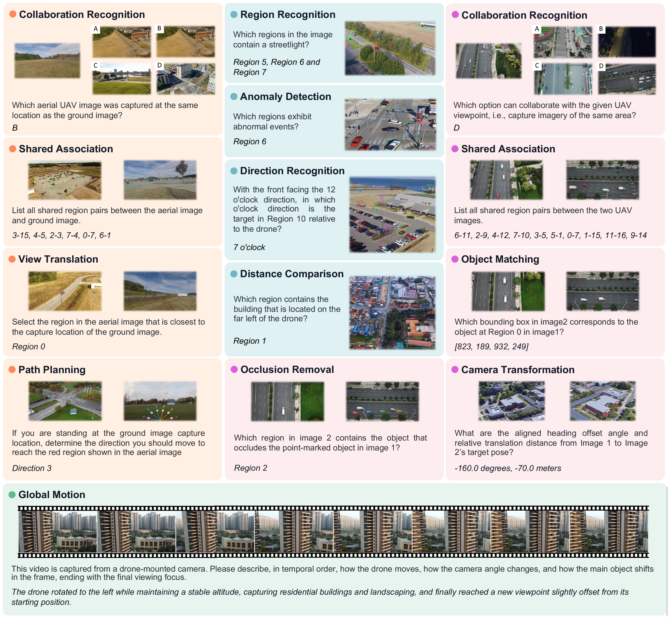
**SpatialUAV** is a benchmark for evaluating spatial intelligence in real low-altitude UAV scenarios. It covers perception, spatial relation reasoning, aerial-aerial collaboration, aerial-ground collaboration, and UAV motion understanding under a unified visual-question-answer format.
## Highlights
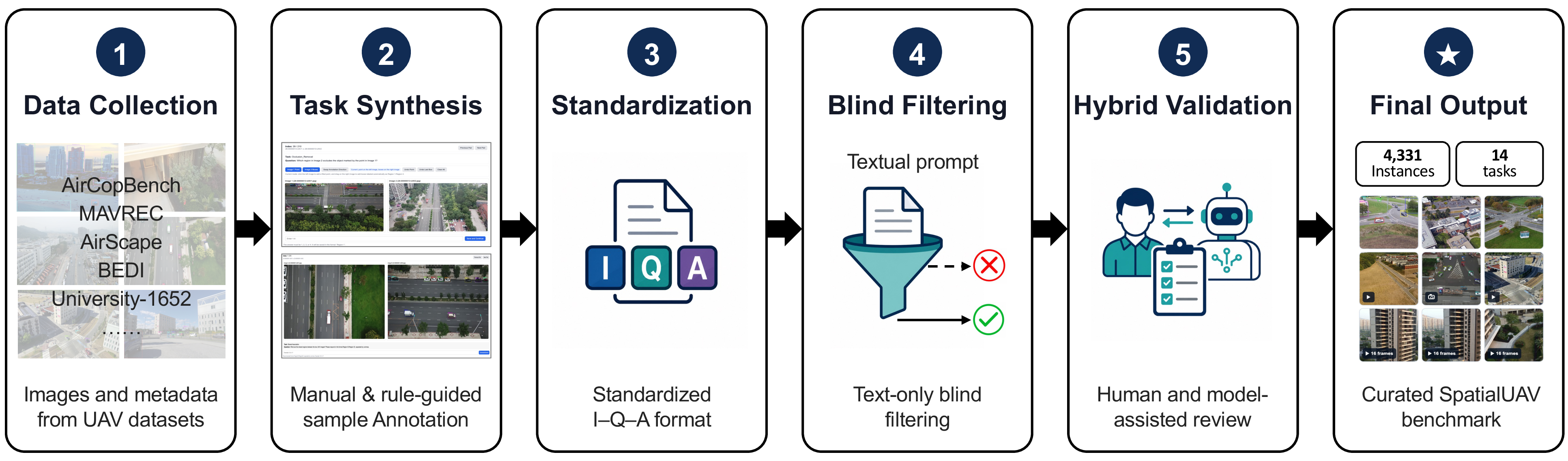
- **4,331 curated instances** from real low-altitude UAV images, videos, and metadata.
- **14 task types** across semantic discrimination, spatial relations, aerial-aerial collaboration, aerial-ground collaboration, and motion understanding.
- **7 visual input configurations** covering single images, paired views, candidate-view selection, annotated images, and ordered video frames.
- **9 answer formats**, including option labels, region IDs, region pairs, bounding boxes, angle-distance values, movement directions, and free-form text.
- **Task-specific evaluation** for heterogeneous outputs instead of relying on one generic text metric.
## Benchmark Overview
| Group | Instances | Task Types | Main Capability |
| --- | ---: | --- | --- |
| Semantic Discrimination | 599 | Region Recognition, Anomaly Detection | Recognize queried objects and safety-critical regions |
| Spatial Relation | 716 | Direction Recognition, Distance Comparison | Infer direction and relative depth from UAV views |
| Aerial-Aerial Collaboration | 1,231 | Collaboration Recognition, Shared Association, Object Matching, Camera Transformation, Occlusion Removal | Match and reason across multiple UAV viewpoints |
| Aerial-Ground Collaboration | 785 | Shared Association, Collaboration Recognition, View Translation, Path Planning | Align aerial and ground observations |
| Motion Understanding | 1,000 | Global Motion | Describe UAV/camera motion over ordered frames |
## Data Format
The annotation file is JSONL. Each line is one benchmark instance:
```json
{
"id": "Region_Recognition_00001",
"image": ["./SpatialUAV/samples_Single_Image/img0001.jpg"],
"conversations": [
{
"from": "human",
"value": "Which regions in the image contain a parking lot? Answer with only the region labels, formatted exactly like `Region 1, 2`. No explanation."
}
],
"source": "SpatialUAV",
"GT": "Region 3, 4."
}
```
Expected dataset layout after download:
```text
SpatialUAV/
annotations.jsonl
annotations_subset_20pct_per_task.jsonl
samples_Single_Image/
samples_A2A_Pured/
samples_A2A_detected/
samples_A2A_Occlusion_Removal/
samples_A2G_Pured/
samples_A2G_detected/
samples_A2G_Path_Planning/
samples_Motion_Understanding_Frames/
```
Use `annotations_subset_20pct_per_task.jsonl` for quick checks and `annotations.jsonl` for full benchmark evaluation.
## Citation
```bibtex
@article{zhang2026spatialuav,
title = {SpatialUAV: Benchmarking Spatial Intelligence for Low-Altitude UAV Perception, Collaboration, and Motion},
author = {Zhang, Haoyu and Liu, Meng and Xiang, Qianlong and Wang, Kun and Wang, Yaowei and Nie, Liqiang},
journal = {arXiv preprint arXiv:2606.27876},
year = {2026}
}
```