metadata
license: apache-2.0
library_name: diffusers
pipeline_tag: image-to-image
tags:
  - controlnet
  - remote-sensing
  - openstreetmap
widget:
  - src: demo_images/input.jpeg
    prompt: convert this openstreetmap into its satellite view
    output:
      url: demo_images/output.jpeg
we do not have a full checkpoint conversion validation, if you encounter pipeline loading failure and unsidered output, please contact me via bili_sakura@zju.edu.cn
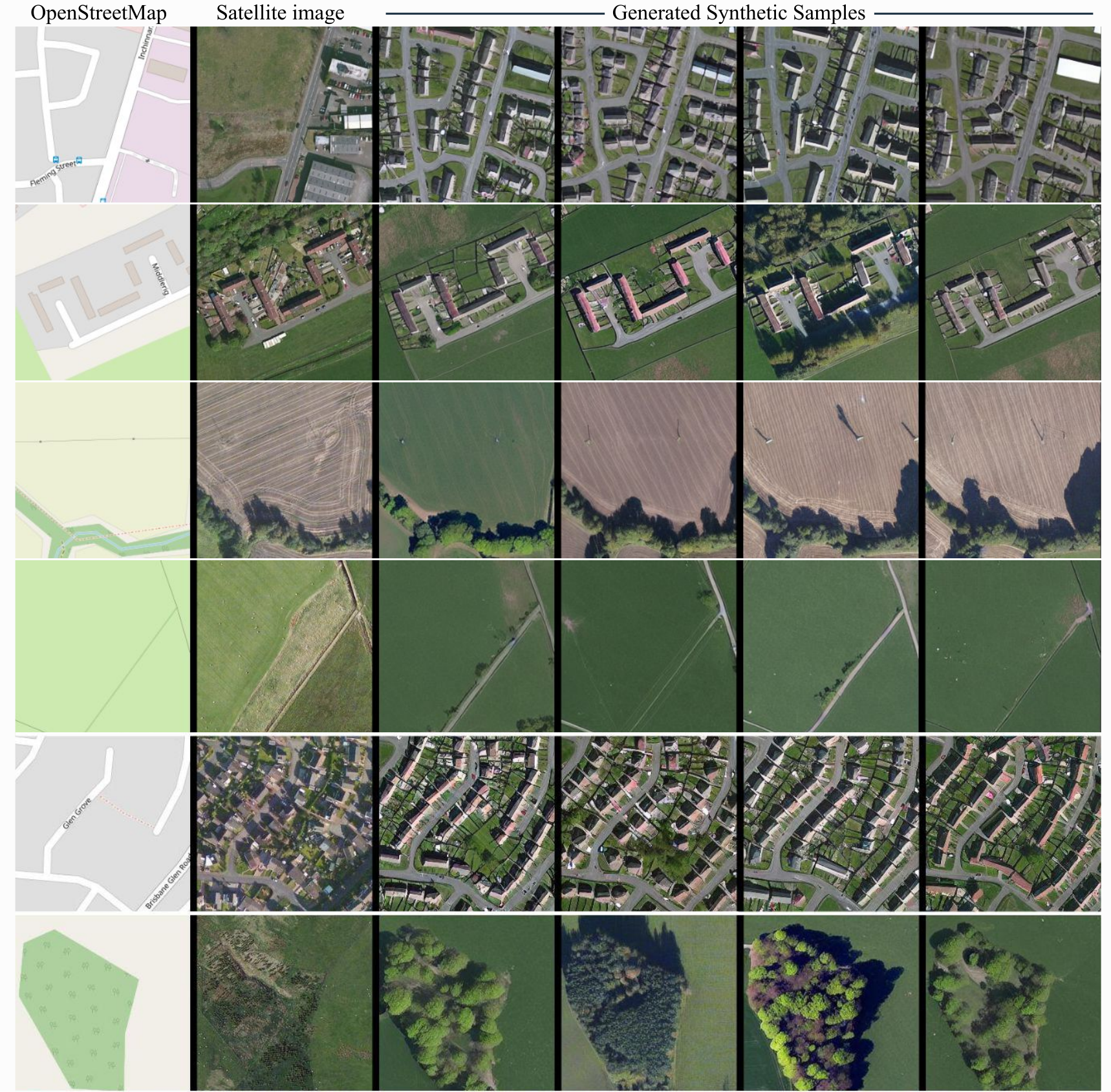
ControlEarth
ControlNet model conditioned on OpenStreetMaps (OSM) to generate the corresponding satellite images.
Trained on the region of the Central Belt.
Repo structure
This repo is self-contained and includes:
- controlnet/ — ControlNet weights (OSM → satellite)
- text_encoder/, unet/, vae/, scheduler/, tokenizer/ — Stable Diffusion v1-5 base
- demo_images/ — Placeholder for input OSM images
- inference_demo.py — Full diffusers inference script (uses only this repo, no external downloads)
Dataset used for training
The dataset used for the training procedure is the WorldImagery Clarity dataset.
The code for the dataset construction can be accessed in https://github.com/miquel-espinosa/map-sat.
Usage
# From the repo root
python inference_demo.py
Or load programmatically:
from diffusers import StableDiffusionControlNetPipeline, ControlNetModel, UniPCMultistepScheduler
import torch

repo = "/path/to/controlearth"  # or "." when run from repo root
controlnet = ControlNetModel.from_pretrained(f"{repo}/controlnet", torch_dtype=torch.float16)
pipe = StableDiffusionControlNetPipeline.from_pretrained(
    repo, controlnet=controlnet, torch_dtype=torch.float16,
    safety_checker=None, requires_safety_checker=False
)
pipe.scheduler = UniPCMultistepScheduler.from_config(pipe.scheduler.config)
pipe.enable_model_cpu_offload()

image = pipe("convert this openstreetmap into its satellite view", num_inference_steps=50, image=control_image).images[0]