
Datasets:

The dataset viewer is not available for this split.
Error code:   StreamingRowsError
Exception:    CastError
Message:      Couldn't cast
shape_leng: double
shape_type: string
depth_m: double
geometry: binary
  -- field metadata --
  ARROW:extension:name: 'geoarrow.wkb'
  ARROW:extension:metadata: '{"crs": {"$schema": "https://proj.org/schema' + 1498
-- schema metadata --
pandas: '{"index_columns": [], "column_indexes": [], "columns": [{"name":' + 545
geo: '{"primary_column": "geometry", "columns": {"geometry": {"encoding":' + 1425
to
{'shape_area': Value('float64'), 'geometry': Value('binary')}
because column names don't match
Traceback:    Traceback (most recent call last):
                File "/src/services/worker/src/worker/utils.py", line 147, in get_rows_or_raise
                  return get_rows(
                      dataset=dataset,
                  ...<4 lines>...
                      column_names=column_names,
                  )
                File "/src/libs/libcommon/src/libcommon/utils.py", line 272, in decorator
                  return func(*args, **kwargs)
                File "/src/services/worker/src/worker/utils.py", line 127, in get_rows
                  rows_plus_one = list(itertools.islice(safe_iter(ds, dataset=dataset), rows_max_number + 1))
                File "/src/services/worker/src/worker/utils.py", line 483, in safe_iter
                  yield from ds.decode(False) if ds.features else ds
                File "/usr/local/lib/python3.14/site-packages/datasets/iterable_dataset.py", line 2840, in __iter__
                  for key, example in ex_iterable:
                                      ^^^^^^^^^^^
                File "/usr/local/lib/python3.14/site-packages/datasets/iterable_dataset.py", line 2373, in __iter__
                  for key, pa_table in self._iter_arrow():
                                       ~~~~~~~~~~~~~~~~^^
                File "/usr/local/lib/python3.14/site-packages/datasets/iterable_dataset.py", line 2398, in _iter_arrow
                  for key, pa_table in self.ex_iterable._iter_arrow():
                                       ~~~~~~~~~~~~~~~~~~~~~~~~~~~~^^
                File "/usr/local/lib/python3.14/site-packages/datasets/iterable_dataset.py", line 536, in _iter_arrow
                  for key, pa_table in iterator:
                                       ^^^^^^^^
                File "/usr/local/lib/python3.14/site-packages/datasets/iterable_dataset.py", line 419, in _iter_arrow
                  for key, pa_table in self.generate_tables_fn(**gen_kwags):
                                       ~~~~~~~~~~~~~~~~~~~~~~~^^^^^^^^^^^^^
                File "/usr/local/lib/python3.14/site-packages/datasets/packaged_modules/parquet/parquet.py", line 220, in _generate_tables
                  yield Key(file_idx, batch_idx), self._cast_table(pa_table)
                                                  ~~~~~~~~~~~~~~~~^^^^^^^^^^
                File "/usr/local/lib/python3.14/site-packages/datasets/packaged_modules/parquet/parquet.py", line 156, in _cast_table
                  pa_table = table_cast(pa_table, self.info.features.arrow_schema)
                File "/usr/local/lib/python3.14/site-packages/datasets/table.py", line 2378, in table_cast
                  return cast_table_to_schema(table, schema)
                File "/usr/local/lib/python3.14/site-packages/datasets/table.py", line 2306, in cast_table_to_schema
                  raise CastError(
                  ...<3 lines>...
                  )
              datasets.table.CastError: Couldn't cast
              shape_leng: double
              shape_type: string
              depth_m: double
              geometry: binary
                -- field metadata --
                ARROW:extension:name: 'geoarrow.wkb'
                ARROW:extension:metadata: '{"crs": {"$schema": "https://proj.org/schema' + 1498
              -- schema metadata --
              pandas: '{"index_columns": [], "column_indexes": [], "columns": [{"name":' + 545
              geo: '{"primary_column": "geometry", "columns": {"geometry": {"encoding":' + 1425
              to
              {'shape_area': Value('float64'), 'geometry': Value('binary')}
              because column names don't match
Need help to make the dataset viewer work? Make sure to review how to configure the dataset viewer, and open a discussion for direct support.
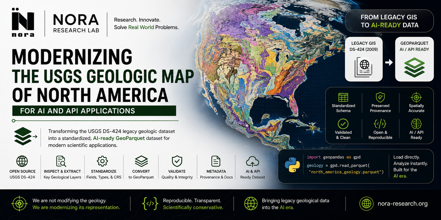




DS-424 Geologic Map of North America — GeoParquet Edition
A standardized, AI/API-ready GeoParquet conversion of the USGS Database of the Geologic Map of North America (DS-424, 2009). This dataset modernizes the original GIS distribution into a format built for programmatic access — no geological reinterpretation, only representation, validation, and metadata enhancement on top of the authoritative USGS/GSA source.
Quick Links
- 📦 Dataset on Hugging Face
- 🧑💻 Source code & pipeline on GitHub
- 🗺️ Original USGS DS-424 publication
- 📄 NGMDB GMNA resources page
- 🏢 NORA Research Lab on Hugging Face
Core Principle
We are not modifying the geology. We are modernizing the representation of the geology.
The original DS-424 dataset remains the authoritative source. This GeoParquet release is a derived, standardized representation intended for modern computational workflows — GeoPandas, databases, AI pipelines, and APIs.
Dataset Contents
| Layer | File | Feature Count | Geometry Type | Notes |
|---|---|---|---|---|
| Geologic Units | geologic_units.parquet |
39,828 | Polygon | 74 invalid geometries repaired (buffer(0)) |
| Geologic Contacts | geologic_contacts.parquet |
53,356 | LineString | — |
| Faults | faults.parquet |
12,424 | LineString | — |
All layers are reprojected to EPSG:4326 (WGS 84) and column names normalized to snake_case.
Usage
import geopandas as gpd

units = gpd.read_parquet("geologic_units.parquet")
contacts = gpd.read_parquet("geologic_contacts.parquet")
faults = gpd.read_parquet("faults.parquet")

print(units.crs)
units.plot(column="rocktype", legend=True)  # example — see metadata.json for actual field names
Or load directly from the Hugging Face Hub:
from huggingface_hub import hf_hub_download
import geopandas as gpd

path = hf_hub_download(
    repo_id="NoraResearchLab/ds424-geologic-map-north-america",
    filename="geologic_units.parquet",
    repo_type="dataset",
)
gdf = gpd.read_parquet(path)
Metadata & Provenance
Full field-level metadata (units, types, CRS, provenance, transformation log) is provided in metadata.json, generated automatically from the conversion pipeline. It documents:
- Source dataset identity and publication details
- Transformation steps applied (reprojection, column normalization, geometry repair)
- Explicit confirmation that no new geological interpretation was introduced
Source Data
- Title: Database of the Geologic Map of North America (DS-424)
- Publisher: U.S. Geological Survey / Geological Society of America
- Publication year: 2009
- Original source: http://pubs.usgs.gov/ds/424/
- Distribution used: Shapefile release (GDAL/OpenFileGDB cannot read the compressed File Geodatabase distribution)
License
Distributed under the same terms as the source USGS/GSA data (public domain / CC0 for USGS-produced data). See the original DS-424 publication for full licensing details.
Citation
If you use this dataset, please cite the original USGS publication:
Garrity, C.P., and Soller, D.R., 2009, Database of the Geologic Map of North America; adapted from the map by J.C. Reed, Jr. and others (2005): U.S. Geological Survey Data Series 424.
And optionally reference this derived GeoParquet edition as prepared by NORA Research Lab.
- Downloads last month
- 41