| | --- |
| | license: mit |
| | --- |
| | |
| | # ADIGE 360 — Autonomous Drone Navigation In GPS-denied Environments |
| |
|
| | <p align="center"> |
| | <img src="adige_logo.png" width="30%"/> |
| | </p> |
| |
|
| | > *The Adige is the second-longest river in Italy, flowing into the Adriatic Sea. Water always finds its way. So should a drone.* |
| |
|
| | When a micro-drone loses its communication link in a GPS-denied indoor environment, it must be able to navigate autonomously toward open space — preserving onboard sensor data that would otherwise be lost with the vehicle. Like water finding its path, the drone follows the open space. |
| |
|
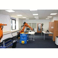
| | | | | | |
| | |:---:|:---:|:---:| |
| | |  |  |  | |
| | |  |  |  | |
| | |  |  |  | |
| |
|
| | Dataset for the paper: |
| |
|
| | **A 360-Degree Vision Dataset for Learning Yaw Control on GPS-Denied Micro-UAVs in Disaster-Response-Relevant Environments** |
| | Niklas Voigt, Hartmut Surmann — Westphalian University of Applied Sciences (WHS) |
| |
|
| | > Code and dataset will be released upon acceptance. |
| |
|
| | 📦 Code: [https://github.com/RoblabWh/adige-360](https://github.com/RoblabWh/adige-360) |