


pretty_name: Consumer Drone City Video
license: other
license_name: kled-commercial-training-license
license_link: https://www.kled.ai/datasets/map-your-flyover
task_categories:
  - video-classification
  - object-detection
tags:
  - kled
  - commercial-license
  - consented-data
  - human-collected
  - sample-on-request
  - video
  - real-world-capture
  - global
  - raw
  - drone
  - aerial
size_categories:
  - 100K<n<1M
annotations_creators:
  - no-annotation
language_creators:
  - crowdsourced
source_datasets:
  - original
viewer: false
gated: manual
extra_gated_heading: Request a sample set of Consumer Drone City Video
extra_gated_prompt: >-
  Kled delivers sample sets and licensed data by email, not through Hugging
  Face. Tell us a little about your work and the Kled data team will send a
  sample set and pricing. Your request goes to team@kled.ai.
extra_gated_fields:
  Company or lab: text
  Role: text
  What are you building: text
  Volume you need:
    type: select
    options:
      - Sample set only
      - Under 10,000 items
      - 10,000 to 100,000 items
      - 100,000 or more items
      - Full dataset
      - Custom collection on the Kled contributor base
  I agree to be contacted by Kled about this request: checkbox
extra_gated_button_content: Request a sample set
extra_gated_description: Prefer email? Write to team@kled.ai with the dataset name in the subject line.
Dataset Card for Consumer Drone City Video
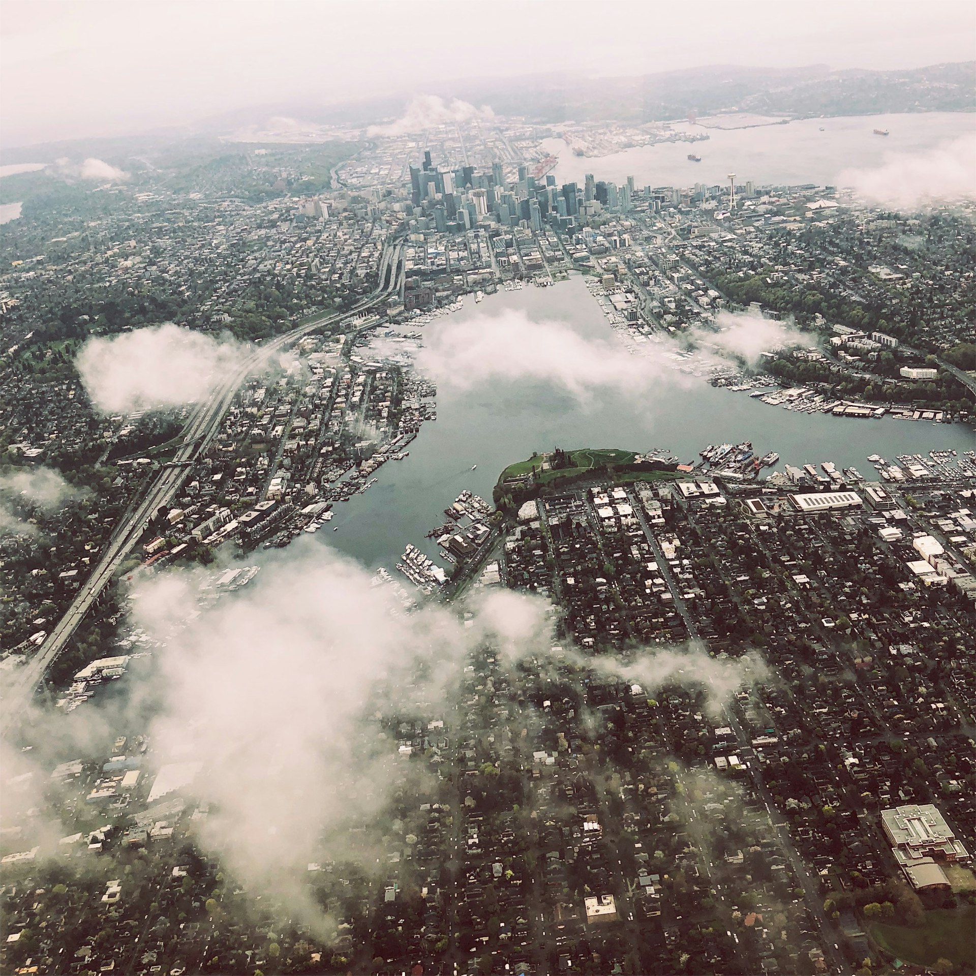
Drone video and aerial stills over streets, buildings and infrastructure, uploaded by pilots from their own flights.
Collected through the Kled app by consenting contributors and licensed for commercial training. The files are delivered by Kled under license, not downloaded from this repository. Use Request a sample set at the top of this page, or write to team@kled.ai. Catalog entry: kled.ai/datasets/map-your-flyover.
Dataset Details
Dataset Description
Contributors upload drone video they shot themselves, steady and clearly showing streets, buildings and infrastructure below, from a global base strongest in Southeast Asia, the United States and Europe, so rooftops, road geometry and urban fabric run from the fast-growing cities of Indonesia, Malaysia and the Philippines, which mapping products cover poorly, to American suburbs and European town centers. No flight log, GPS track, calibration or annotation; altitudes, angles and drone models vary by pilot. Aerial training data is otherwise satellite imagery, top-down and coarse, or academic drone sets (VisDrone, UAVDT), small, benchmark-built and shot in China; consumer drone footage is the third category and little of it has been licensed for training.
- Curated by: Kled (useKled)
- Collected through: Drones
- Regions: Global, 100+ countries
- Volume: 100,000+ clips and stills (approx. 20 TB)
- Contributors: 5,000+
- Modality: Video
- Format: MP4 / MOV
- Resolution: 1080p to 4K as recorded by the drone (MP4, MOV)
- Annotations: Raw (no labels)
- Quality control: 99%+ passed QA review
- License: Non-exclusive commercial training license (terms); exclusivity available on request
- Consent: Each contributor opted in to this use when they uploaded.
Dataset Sources
- Catalog page: kled.ai/datasets/map-your-flyover
- Sample set: through the access request at the top of this page, or team@kled.ai
- Publisher: huggingface.co/useKled
Uses
Direct Use
- Aerial scene understanding and mapping
- Infrastructure inspection pretraining
- Drone perception evaluation
Out-of-Scope Use
Redistribution or resale of the files, use outside the terms of the commercial training license, and any attempt to identify or contact contributors or people who appear in the data. Uses that require labels this set does not carry should be scoped with the data team first.
Dataset Structure
Data Instances
One clip with its stills per record, delivered as MP4 / MOV. Volume: 100,000+ clips and stills.
Data Fields
- File: the MP4 / MOV file as captured or uploaded by the contributor
- Labels: none; the set is delivered raw. Labeling on the same items is available on request.
- Capture metadata: capture tool, country of capture, submission time
- Review status: QA outcome (99%+ passed QA review)
Field names and the manifest format are confirmed with the sample set.
Data Splits
Delivered as one set. Subsets by country, language or label, and custom splits, are available on request.
Dataset Creation
Curation Rationale
The dataset exists because the public alternatives named in the description are non-commercial, synthetic, small or collected elsewhere. Kled runs the task as a paid brief in its app so that the data is captured on purpose, under the capture rules above, by people who have opted in to commercial use.
Source Data
Data Collection and Processing
Contributors complete the task in the Kled app. Capture tool: Drones. Each submission is reviewed against the task brief; submissions that break the capture rules are rejected. 99%+ passed QA review. Files are delivered as MP4 / MOV, in the resolution noted above.
Who are the source data producers?
Kled contributors, who complete paid data tasks on their own phones. This task was open to contributors worldwide. Kled has 625,000+ contributors in 100+ countries, strongest in Southeast Asia, the United States and Europe.
Annotations
Annotation process
No annotations are included. Items are delivered as captured; labeling on the same items can be scoped with the data team.
Who are the annotators?
Not applicable; no annotations are included.
Personal and Sensitive Information
Every item was contributed by its owner, who opted in to this use at upload. The task brief states what may and may not appear in a submission, and reviewers reject submissions that break those rules. Kled's data handling practices are documented at trust.kled.ai; questions about handling requirements for your use go to team@kled.ai.
Bias, Risks, and Limitations
Coverage follows the contributor base: strongest in Southeast Asia, the United States and Europe, thinner elsewhere, and not limited by region for this task. Devices, settings and conditions vary by contributor, which is the point of the collection and also means no two items are captured under identical conditions. Where labels are contributor-entered, they are checked at review but are not expert annotations. Volumes are the current scope of the task and grow as collection continues.
Recommendations
Request a sample set and run it against your task before licensing. Ask for per-country or per-language counts where they matter to your use.
Licensing Information
Non-exclusive commercial training license; exclusivity on request. Each contributor opted in to this use when they uploaded. The license terms are on the catalog page.
Citation
@misc{kled_map_your_flyover_2026,
  title        = {Consumer Drone City Video},
  author       = {Kled},
  year         = {2026},
  url          = {https://www.kled.ai/datasets/map-your-flyover},
  note         = {Commercially licensed dataset collected through the Kled app. Sample sets on request.}
}
Dataset Card Contact
Kled data team: team@kled.ai