|
|
--- |
|
|
license: apache-2.0 |
|
|
--- |
|
|
*(Note that this model is for comparison purposes only. |
|
|
A better performing model can be found [here](https://huggingface.co/tostyfrosty/controlearth).)* |
|
|
|
|
|
# Model description |
|
|
|
|
|
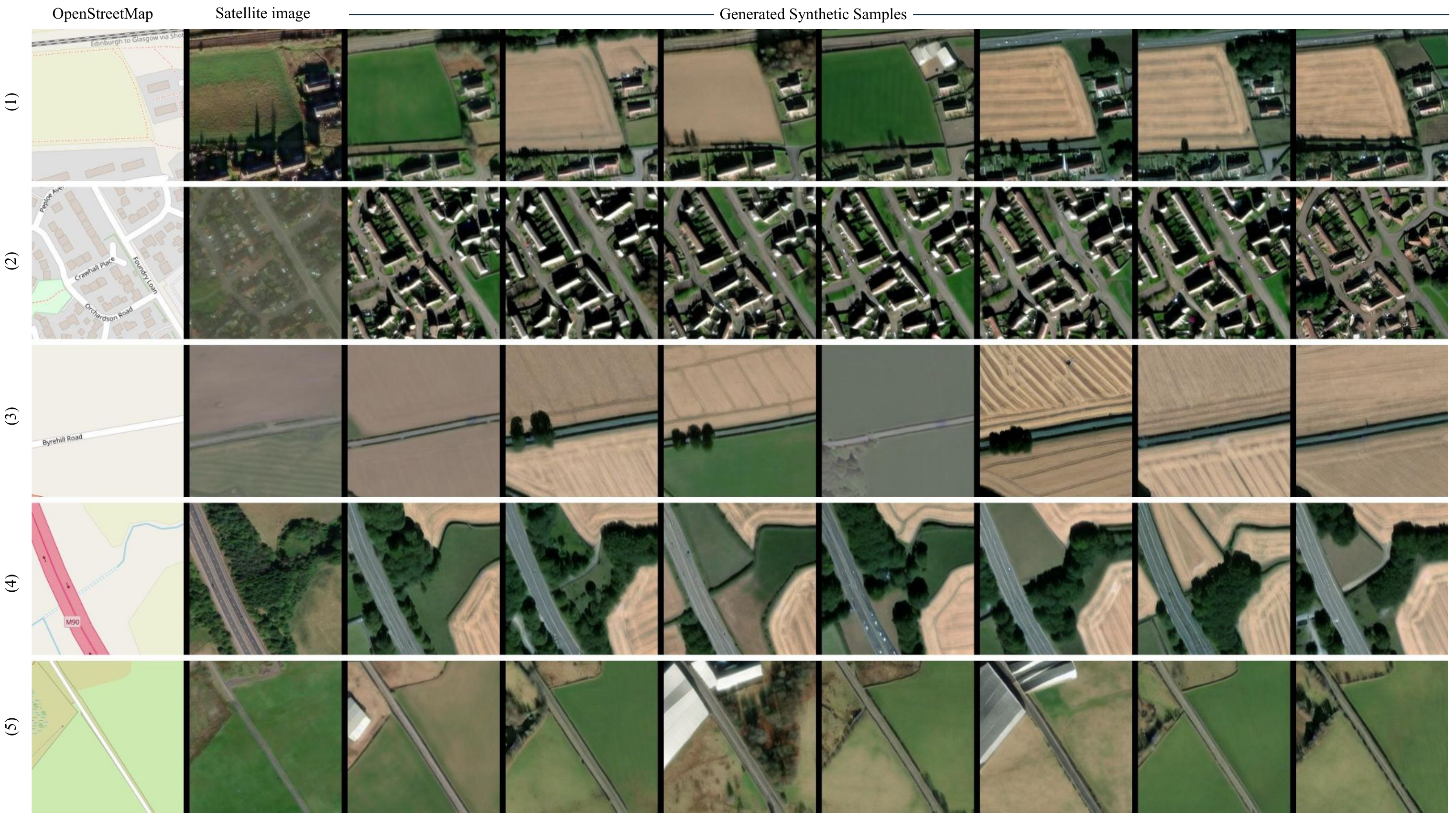
ControlNet model conditioned on OpenStreetMaps (OSM) to generate |
|
|
the corresponding satellite images. |
|
|
|
|
|
Trained on the region of Scotland. |
|
|
|
|
|
*To access the **better performing model** trained on the WorldImagery Clarity dataset, see [this model](https://huggingface.co/mespinosami/controlearth).* |
|
|
|
|
|
## Dataset used for training |
|
|
The dataset used for the training procedure is the |
|
|
[WorldImagery dataset](https://www.arcgis.com/home/item.html?id=10df2279f9684e4a9f6a7f08febac2a9). |
|
|
This dataset is qualitatively worse than its predecessor |
|
|
[WorldImagery Clarity dataset](https://www.arcgis.com/home/item.html?id=ab399b847323487dba26809bf11ea91a). |
|
|
|
|
|
The code for the dataset construction can be accessed in https://github.com/miquel-espinosa/map-sat. |
|
|
|
|
|
 |
